
Attunement to Landscapes: Attention & Fly Fishing
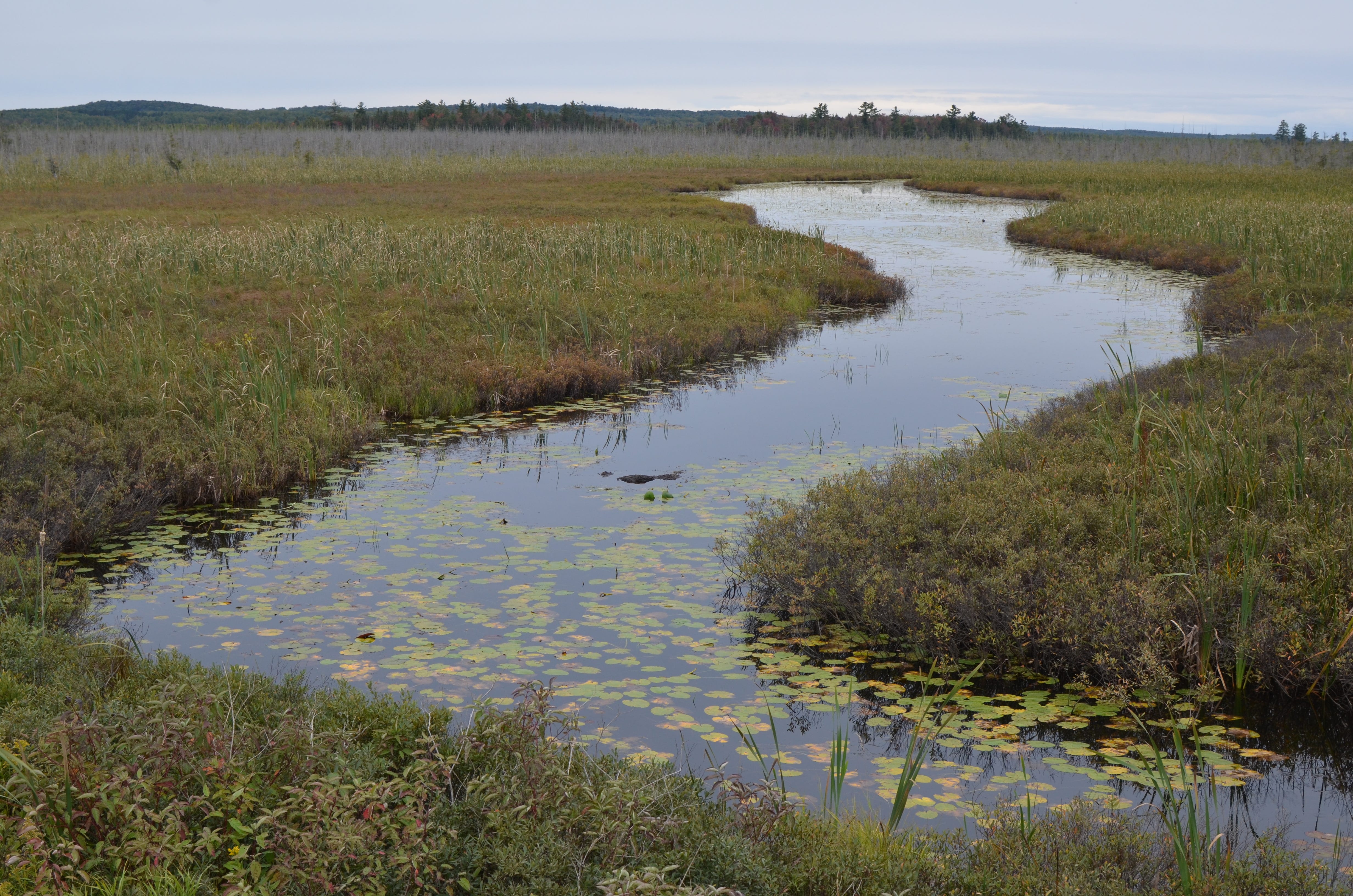
Returning to the same rivers over a season reveals a cumulative record worth preserving.

Today I’m announcing something that has been in the works for some time, and I’m sharing an ethos document for one division of my practice that you might not be aware of yet: ANGLING DIVISION which is a private fly fishing intelligence bureau of sorts, built from member-contributed catch logs and river observations across the entire Great Lakes watershed on a seasonal cycle.
You don’t have to be a trout bum or enjoy recreational fishing to benefit from the perspective I share below, you just have to care about learning more about landscapes you love, which I think is probably everyone who reads my work here. And don’t worry, this doesn’t mean I’m going to start posting about fly fishing regularly, unless I have something to share that informs my broader research in the glacial landscapes of the Great Lakes.
This article uses fishing as its surface language, but the underlying project is squarely about perception and landscape intelligence. How rivers organize themselves. How shorelines remember ice. How attention sharpens when the environment has consequences. If you’ve ever cared about reading terrain, water, weather, or history written into land, you’re already the audience for ANGLING DIVISION.
Toward the end of this post, I’ll introduce Room 1910, the division’s field outfitter, where objects are produced as extensions of this practice; material investigations that allow research to exist in hand, in texture, and in place.
The Ethos of ANGLING DIVISION
Returning to the same rivers over a season reveals a cumulative record worth preserving.
The rivers of the Great Lakes region are not incidental features of the landscape. In northern Ohio and across much of the HUC4 basin, nearly every river and stream ultimately drains to the Great Lakes, binding local waters directly to the glacial basins left by the retreat of the Laurentide Ice Sheet. These rivers occupy valleys shaped by ice, meltwater, and sediment, and continue to adjust within those inherited forms.
To fish a river repeatedly is to encounter change at a human scale within a geological framework. Water levels shift, substrates move, banks erode or stabilize, vegetation advances or recedes. Fish appear, disappear, or return. These changes are often noticed by anglers long before they are measured elsewhere.
ANGLING DIVISION takes this attentiveness seriously.
Rivers are sites of ongoing formation.
The river valleys of the Great Lakes region emerged from glacial retreat and meltwater drainage. Moraines, outwash plains, and proglacial spillways established the courses that modern rivers continue to follow. While the ice is gone, the systems it left behind remain active.
Rivers are therefore not static corridors but active sites of ongoing formation. They register seasonal cycles, extreme events, and long-term adjustments. They are among the most legible places to observe how deep time and present practice intersect.
ANGLING DIVISION treats the river not only as a place to fish, but as a place to learn.
Practice produces a specific kind of record worth collecting.
Anglers return to the same waters across seasons and years. They notice water clarity, temperature, flow, access, and fish behavior. This knowledge is often informal and personal, retained in memory or notebooks, and lost when individuals move on.
ANGLING DIVISION proposes that this knowledge can be logged without stripping it of its character, and be useful to contributing members who want to see their favorite reach in the context of the broader basin hydrology.
Members are invited to record their catches through a simple submission process, noting date, general location, species, and conditions. Exact precision is not as important as continuity is. Coordinates may refer to stretches of river rather than exact points, you don’t have to give away your secret spot. What matters is repeatability over time.
These submissions form a cumulative record of attention.
We’re building a repository for stewardship.
ANGLING DIVISION is not a regulatory body, a research institution, or an advocacy organization. It does not issue directives or extract data for third parties.
Instead, it operates as a stewarded repository of observations generated through practice. Over time, aggregated records reveal patterns of presence, absence, or change. When appropriate, this material can be shared outward in careful, limited ways, with the consent of members, and without relinquishing control of the archive, and without giving away people’s secret fishing spots.
Data is just data until it produces a material record.
ANGLING DIVISION is intentionally not an app, not a dashboard, and not a real-time feedback system. There are no live maps, alerts, rankings, or feeds. The work happens on the river, in notebooks, in memory, and through seasonal return. Submissions are simple by design and processed slowly, on a human timescale that mirrors how rivers actually change. The primary outputs are printed ledgers and physical objects, not screens. While users submit catch logs through online forms, this is a practice rooted in land rather than devices, in accumulated attention rather than continuous connectivity. The Division exists to pull observation out of the phone and back into the field, where perception is shaped by weather, access, fatigue, light, and consequence.
ANGLING DIVISION is committed to physical artifacts.
At the close of each season, members receive a material record derived from their submissions: River Ledger, a printed report and a compiled register of how the rivers behaved this season across the full set of data-contributing individual anglers. Occasionally, in addition to River Ledger, I produce field objects under the aegis of Room 1910 (the quiet outfitter room of my studio), and these items are made available to data-contributing members first before being released to the general public.
As with other FIELD OFFICE publications and objects, these materials are designed to endure, circulate, and be conserved by their holders.
ANGLING DIVISION membership is an invitation to pay attention, to record without spectacle, and to belong to a practice that values rivers as places shaped by ice, water, and time, and by the anglers that return to them, time and again.
Membership keeps you committed to contributing quality data.
ANGLING DIVISION functions as a private membership club in the tradition of physical fish camps and river associations, but for the sake of ensuring quality data rather than for the sake of exclusivity.
Members contribute seasonal observations to a curated regional record, participating in a shared archive that values rivers as lived systems rather than abstract resources.
Membership does not grant access to exclusive waters, nor does it confer authority; hierarchy within the Division is minimal and largely ceremonial, reflecting roles of care, observation, and stewardship. Those reasons fit with what most flyfishing anglers come to the sport for in the first place. This membership is available for you to compare your catch data against the broader hydrology landscape of the Great Lakes basin.
The Division does not advocate policy, manage waterways, or operate as a conservation organization, its purpose is observational, building a long-term record of rivers, species, and seasonal patterns across the region.
ANGLING DIVISION is a natural extension of FIELD OFFICE.
ANGLING DIVISION operates within FIELD OFFICE as a long-term institutional experiment. It extends my existing practice concerned with archives, material culture, and non-institutional knowledge transmission into the domain of rivers and angling. FIELD OFFICE is primarily concerned with understanding the glacial landscapes of the Great Lakes north to the Arctic Circle, and it functions as a way to tune attention to the land. Anglers attune to the rivers that cross these lands, and so I began ANGLING DIVISION as a way to make something with the flyfishing community, to build something that no state agencies, fisheries, or conservation organizations produce. It’s a new way to understand sites in their past, present, and future contexts.
Because of this connection, ANGLING DIVISION documents, ledgers, and objects are issued under FIELD OFFICE to ensure continuity beyond seasons, platforms, or individual participation.
A closing note as we move toward spring:
As the ice retreats and rivers awaken to spring flows, I will find myself drawn once again to the familiar bends and riffles, where water shapes gravel, moss clings to stones, and trout trace the shadows of overhead trees. Each visit to my favorite reaches reminds me that these rivers are not static; they are sites of quiet transformation, marked by shifting currents, fluctuating clarity, and the subtle passage of time.
By logging our observations and catches over the coming season, we create more than a record of fish. We build a continuity of attention, a cumulative picture of these waters, and a practice that binds our own understanding to the rhythms of the watershed. Every entry, whether brief or detailed, contributes to a shared archive that will outlast any single season or angler.
I look forward to seeing the rivers through your eyes as much as my own, and to preserving a season’s worth of insight in our collective ledger.