
Composite Statistical Image Analysis
Seeing the Landscape in Aggregate

When I engage a site one of the first questions I ask is: what does the terrain actually record? In one of my sites, a limestone quarry in the Lake Erie Archipelago, the answer to that question was puzzling at first. Quarries are in the business of removing stone, but this limestone quarry was littered with granite and other igneous stones. I started paying attention to these granitic stones, and began taking an inventory (ryandewey.org/glacial-stone-inventory). By approaching this oddity in a rigorous, visual, and structured way, I started to get a sense of what was being recorded in the site. These pieces of granite were glacially transported boulders that had arrived in the slather of glacial till which had settled as the overburden atop this limestone pavement. They were out of geologic place, too difficult to deal with, and consequentially left behind by the quarry workers as debris. My inventory approached this site systematically and attempted to capture the distribution, size, and shape of glacially transported stones across this specific landscapes and to render that data as an interpretable resource.


At the heart of this work is Composite Statistical Image Analysis (CSIA). Rather than treating individual stones as isolated curiosities, CSIA aggregates large numbers of observations into composite images. These images reveal patterns that are otherwise invisible: directional trends, clustering, relative size distributions, and morphological variation across stones in a given site.
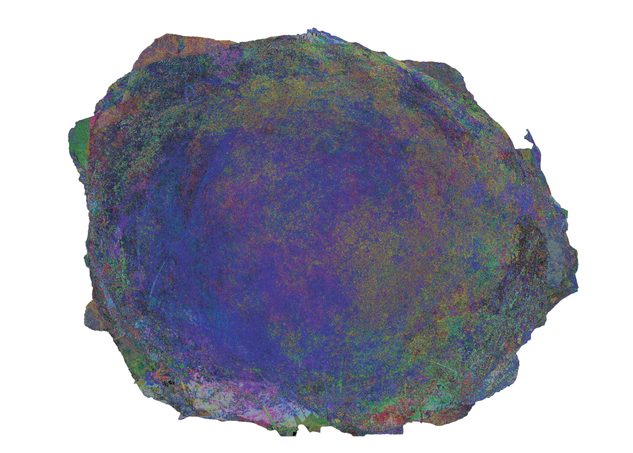
What the collection of composite images make clear is not just what is there, but what it signifies. Recurrent forms, consistent alignments, and subtle deviations signal the underlying physical processes that shaped the landscape, but also the social processes since the presence of these mismatch stones makes legible the decision-making workflow of the economics of this particular site. In other words, the analysis exposes the grammar of the terrain, the constraints, forces, and histories that have produced what we see.
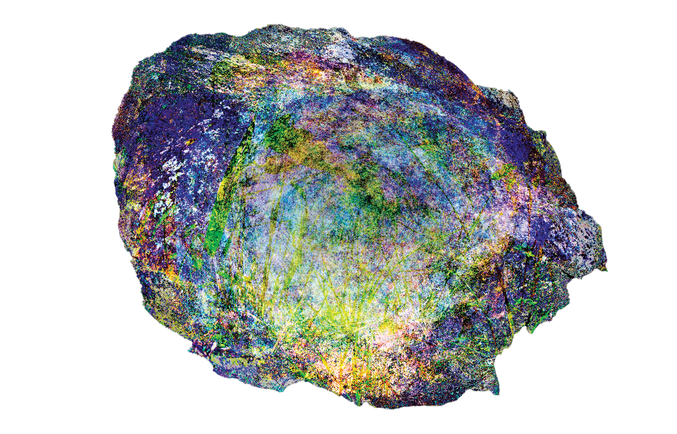
These visuals are striking, but their value goes beyond aesthetics. Images like these allow me to:
Identify spatial structures and correlations that would be difficult to discern on the ground
Compare multiple sites or areas systematically
Translate raw field observations into analytical models that inform decision-making
For land stewards or site managers, this approach provides a nuanced, evidence-based perspective. CSIA does not dictate what a site “means,” but it surfaces signals that support strategic intervention, conservation planning, or interpretive design. Where conventional mapping might register only topography or coverage, composite statistical images reveal latent organization in materials and patterns that can inform stewardship at both the micro and macro scales.
The Glacial Stone Inventory is ongoing, and the CSIA work continues to expand its reach. Each new composite strengthens the capacity to discern meaningful structures in the landscape, making the site itself a live archive of insight. This is a system to see the landscape as an active, interpretable system and the project provides a working methodology and visual language for reading the landscape.
These methods continue to inform how I engage sites with land stewards and institutions seeking a deeper, evidence-based understanding of the landscapes they manage. Further materials from the Glacial Stone Inventory and related FIELD OFFICE work will be published as the project develops.